Storm Water Project - Crest Gauge Installation
performed on 12/16/2008
Download Excel spreadsheet
![]()
Site List - click on link to jump to specific site
| Site Number | Site Description | Abbevation |
| 1 | Agnew Ditch at Finn Hall Road | AgFnHall |
| 2 | Highland Ditch d/s Washington St | HldWash |
| 3 | Bell Creek d/s Blake Ave | BelBlake |
| 4 | Los Palomas Restaurant; manhole in front of | SqBayRd |
| 5 | Highland ditch d/s Happy Valley Rd | HldHpyVly |
| 6 | Eureka Ditch behind 775 W Washington | EurWash |
| 7 | Lotzgesell Creek d/s Woodcock Rd | LotzWdck |
| 8 | Meadowbrook Creek u/s ditch | MdwCr |
| 9 | Meadowbrook Ditch u/s Meadowbrook Creek | MdwDtch |
| 10 | Safeway parking lot catch basin; in front of store | SfwyCB |
| 11 | Home Depot swale | |
| 12 | Rhodefer Road (SE of W Sequim Bay Rd) | |
| 12 | Jimmy Come Lately Creek - Forested | JCLWooded |
| 14 | Jimmy Come Lately Creek - Field | JCLField |
| Sequim-Area Stormwater Sampling Sites for 2008-09 Water Year | ||||||||||||||||||||||||||||||||||||||||||||||||||||||||||||||||||||||||||||||||||||||||||||||||||||||||||||||||||||||||||||||||||||||||||||||||||||||||||||||||||||||||||||||||||||||||||||||||||||||||||||||||||||||||||||||||||||||||||||||||||||||||||||||||||||||||||||||||||||||||||||||||||||||||||||||||||||||||||||||||||||||||||||||||||||||||||||||||||||||||||||||||||||||||||||||||||||||||||||||||||||||||||||||||||||||||||||||||||||||||||||||||||||||||||||||||||||||||||||||||||||||||||||||||||||||||||||||||||||||||||||||||||||||||||||||||||||||||||||||||||||||||||||||||||||||||||||||||||||||||||||||||||||||||||||||||||||
| Baseline data for Crest Guage Installation; December 16, 2008 (unless otherwise noted) | ||||||||||||||||||||||||||||||||||||||||||||||||||||||||||||||||||||||||||||||||||||||||||||||||||||||||||||||||||||||||||||||||||||||||||||||||||||||||||||||||||||||||||||||||||||||||||||||||||||||||||||||||||||||||||||||||||||||||||||||||||||||||||||||||||||||||||||||||||||||||||||||||||||||||||||||||||||||||||||||||||||||||||||||||||||||||||||||||||||||||||||||||||||||||||||||||||||||||||||||||||||||||||||||||||||||||||||||||||||||||||||||||||||||||||||||||||||||||||||||||||||||||||||||||||||||||||||||||||||||||||||||||||||||||||||||||||||||||||||||||||||||||||||||||||||||||||||||||||||||||||||||||||||||||||||||||||||
|
||||||||||||||||||||||||||||||||||||||||||||||||||||||||||||||||||||||||||||||||||||||||||||||||||||||||||||||||||||||||||||||||||||||||||||||||||||||||||||||||||||||||||||||||||||||||||||||||||||||||||||||||||||||||||||||||||||||||||||||||||||||||||||||||||||||||||||||||||||||||||||||||||||||||||||||||||||||||||||||||||||||||||||||||||||||||||||||||||||||||||||||||||||||||||||||||||||||||||||||||||||||||||||||||||||||||||||||||||||||||||||||||||||||||||||||||||||||||||||||||||||||||||||||||||||||||||||||||||||||||||||||||||||||||||||||||||||||||||||||||||||||||||||||||||||||||||||||||||||||||||||||||||||||||||||||||||||
| (1) | Staff Height Reference | The vertical distance from the stated benchmark. Positive figures means the staff gauge was above the benchmark | ||||||||||||||||||||||||||||||||||||||||||||||||||||||||||||||||||||||||||||||||||||||||||||||||||||||||||||||||||||||||||||||||||||||||||||||||||||||||||||||||||||||||||||||||||||||||||||||||||||||||||||||||||||||||||||||||||||||||||||||||||||||||||||||||||||||||||||||||||||||||||||||||||||||||||||||||||||||||||||||||||||||||||||||||||||||||||||||||||||||||||||||||||||||||||||||||||||||||||||||||||||||||||||||||||||||||||||||||||||||||||||||||||||||||||||||||||||||||||||||||||||||||||||||||||||||||||||||||||||||||||||||||||||||||||||||||||||||||||||||||||||||||||||||||||||||||||||||||||||||||||||||||||||||||||||||||||
| (2) | Bottom of Meadowbrook Creek is VERY soft. Needs longer stake | |||||||||||||||||||||||||||||||||||||||||||||||||||||||||||||||||||||||||||||||||||||||||||||||||||||||||||||||||||||||||||||||||||||||||||||||||||||||||||||||||||||||||||||||||||||||||||||||||||||||||||||||||||||||||||||||||||||||||||||||||||||||||||||||||||||||||||||||||||||||||||||||||||||||||||||||||||||||||||||||||||||||||||||||||||||||||||||||||||||||||||||||||||||||||||||||||||||||||||||||||||||||||||||||||||||||||||||||||||||||||||||||||||||||||||||||||||||||||||||||||||||||||||||||||||||||||||||||||||||||||||||||||||||||||||||||||||||||||||||||||||||||||||||||||||||||||||||||||||||||||||||||||||||||||||||||||||
1 - Agnew Ditch at Finn Hall Road (top of page)
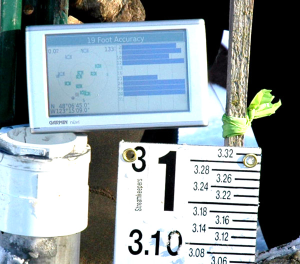
GPS location of crest gauge in Agnew Ditch at Finn Hall Rd
Crest gauge installed in NE corner of box & set to same height as the original staff gauge
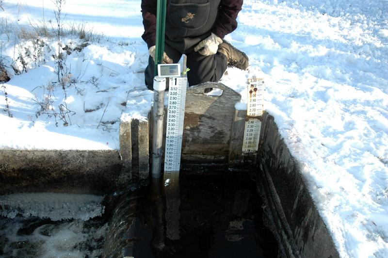
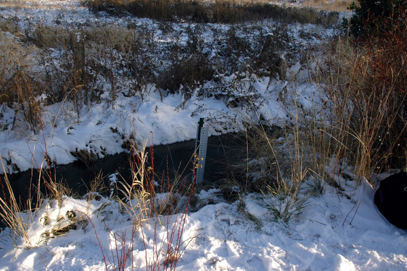
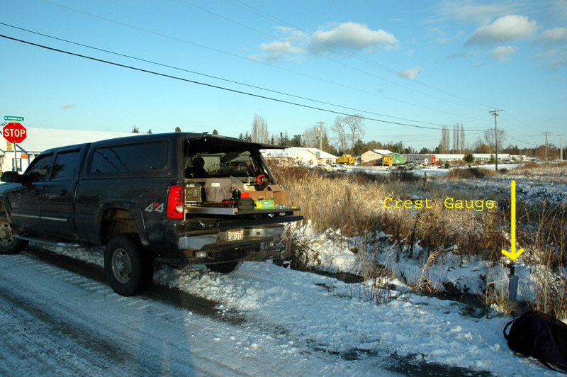
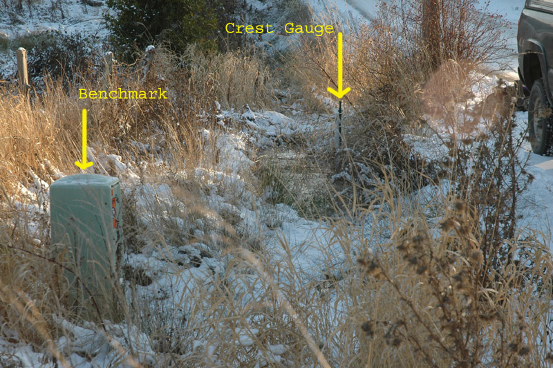
2 - Highland Ditch d/s Washington St (top of page)
GPS location of Highland Ditch d/s of E Washington St
Installation of crest gauge
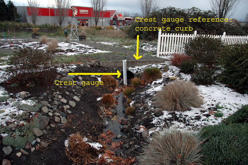
Overview of crest gauge location
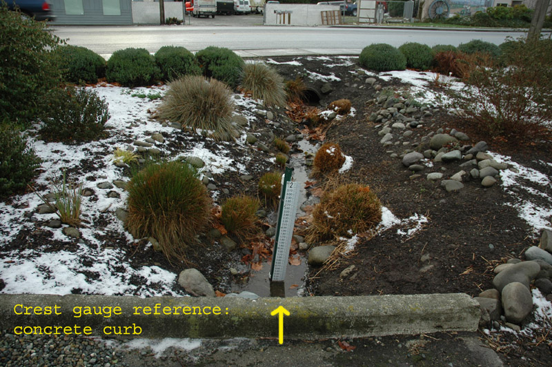
Crest gauge reference point
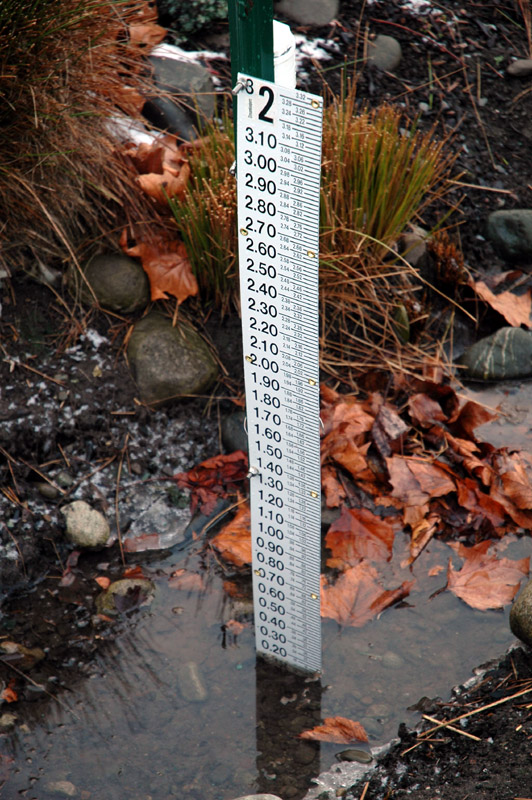
Water in ditch the day after installation
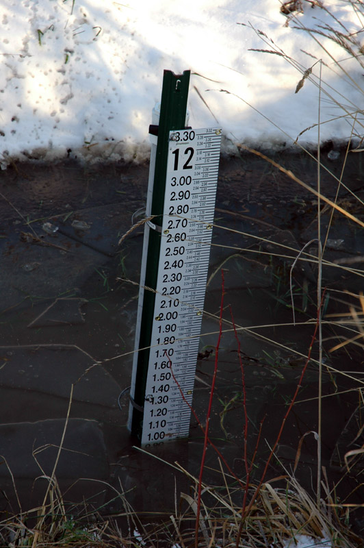
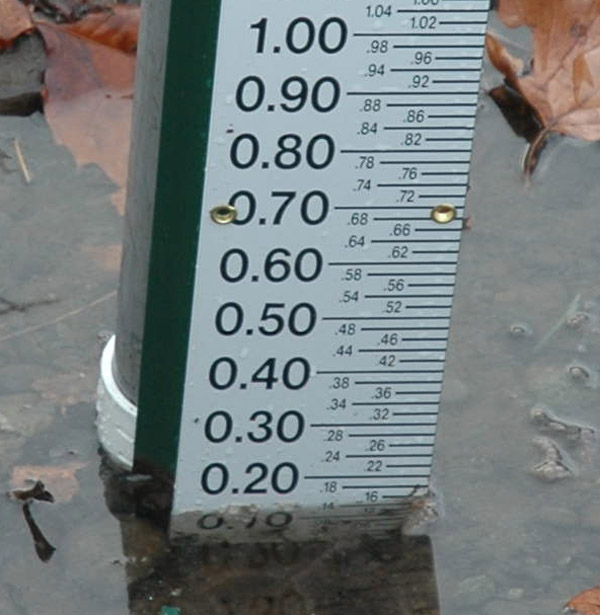 Water depth: 12/17/2008 @ 1523
3 - Bell Creek d/s Blake Ave (top of page)
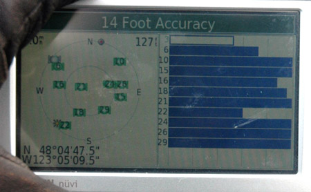
GPS location of crest gauge in Bell Creek d/s of Blake Ave
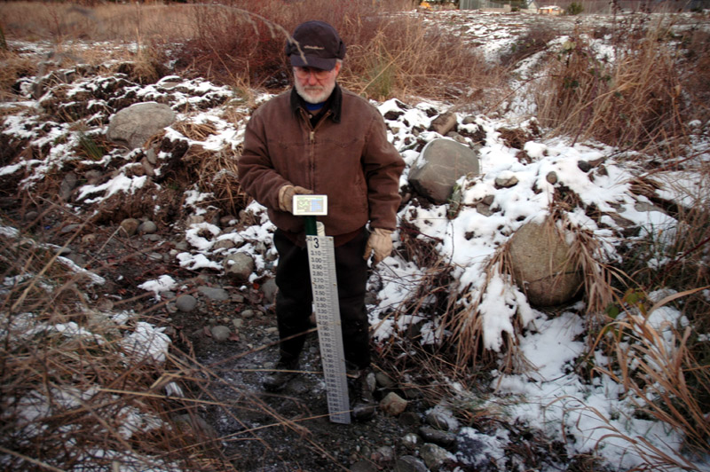
Installation of crest gauge in Bell Creek d/s of Blake Ave
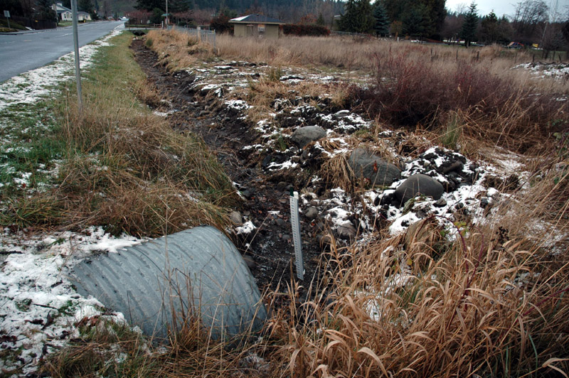
General view of crest gauge in Bell Creek d/s of Blake Ave
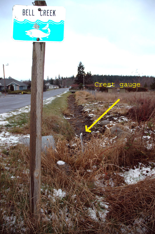
Annotated view of crest gauge in Bell Creek
View showing crest gauge height reference point
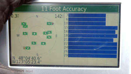
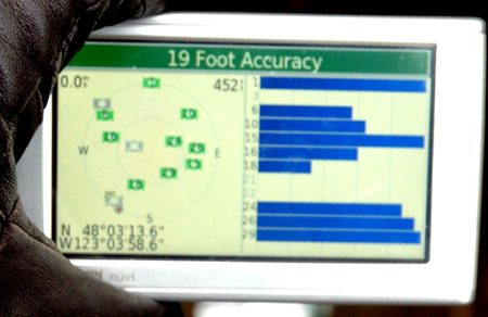
4 - Los Palomas Restaurant; manhole in front of driveway (top of page)
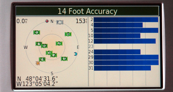
Location (where truck is parked)
N 48º 04' 31.6"
W 123º 05' 04.2"
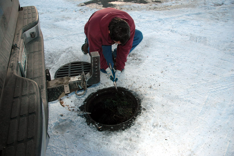
Cleaning vegetation from inside of manhole after removing cover
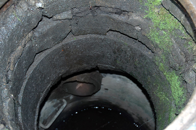
Interior of manhole, looking north
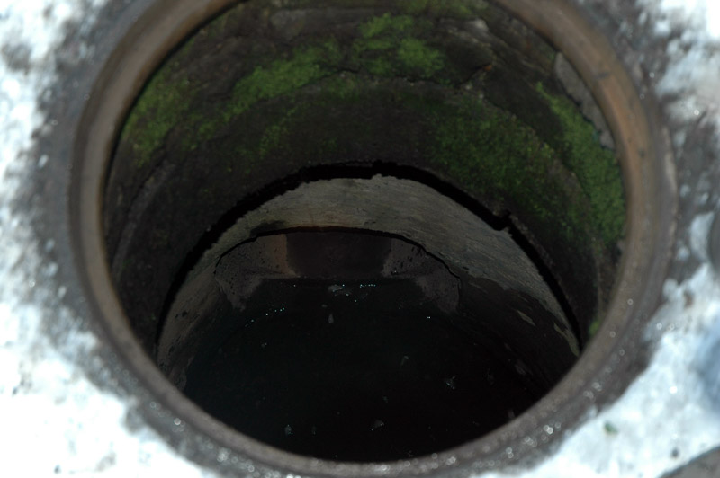
Interior of manhole, looking east
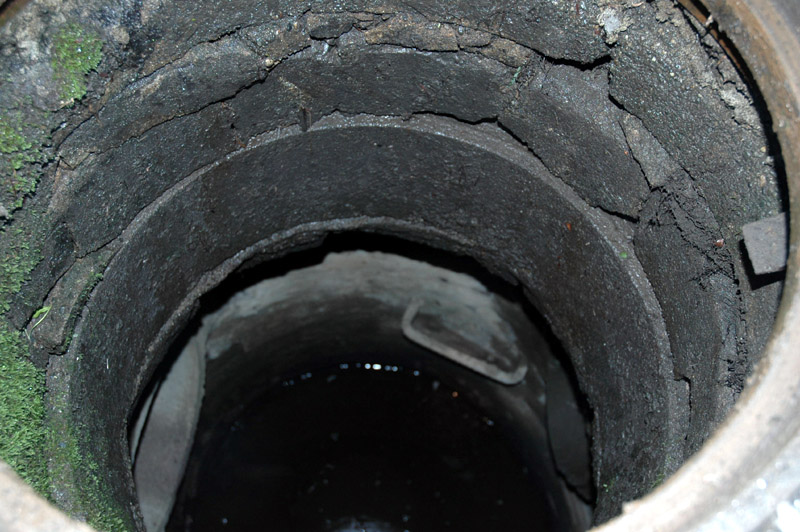
Interior of manhole, looking south
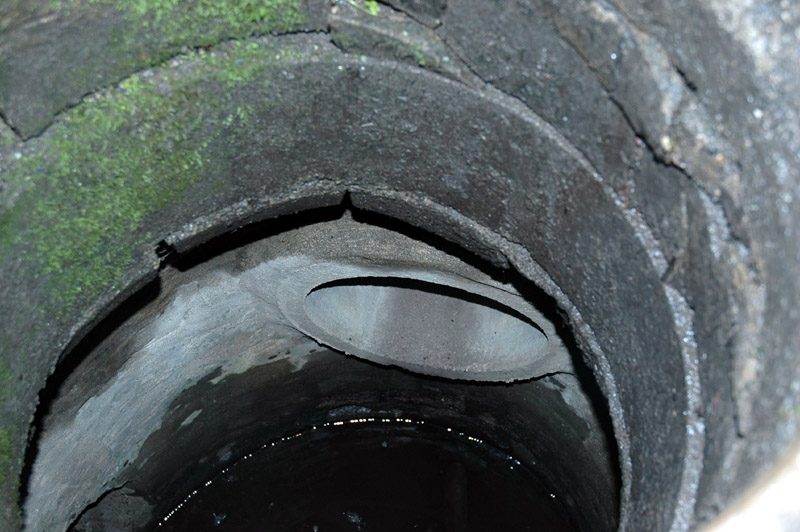
Interior of manhole, looking west
5 - Highland ditch d/s Happy Valley Rd (top of page)
GPS location of crest gauge in Highland Ditch d/s of Happy Valley Rd
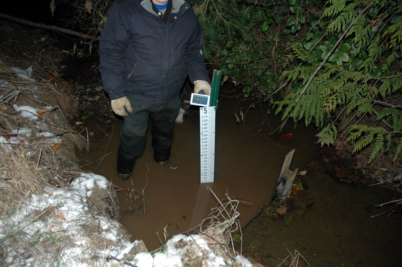
Installation of crest gauge
Depth: 12/16/2008 @ 1654: 1.02'
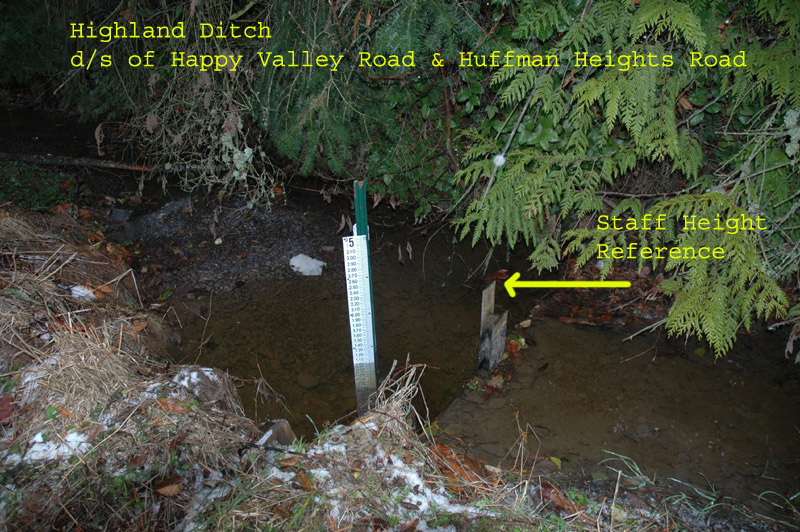
Crest gauge reference point
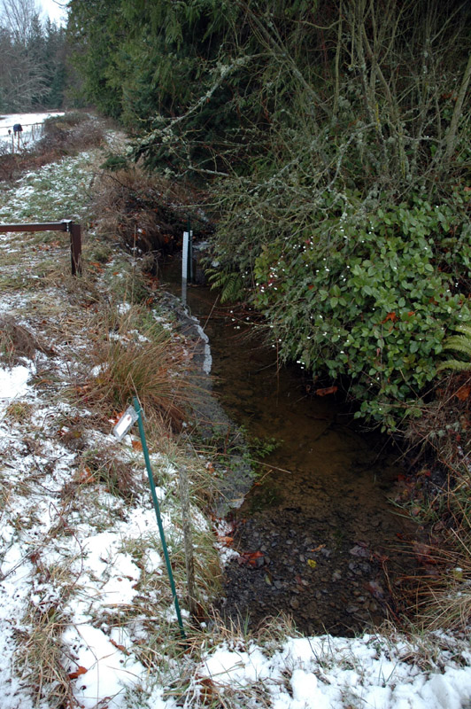
Overview of crest gauge in Highland Ditch d/s of Happy Valley Rd
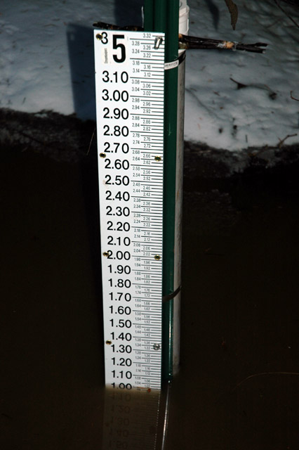
Depth: 12/21/2008 @ 1612: 1.00'
6 - Eureka Ditch behind 775 W Washington (top of page)
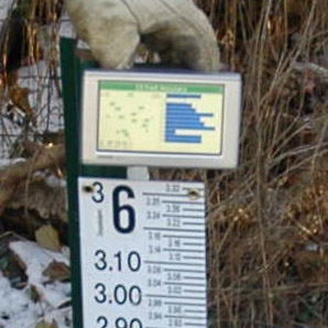
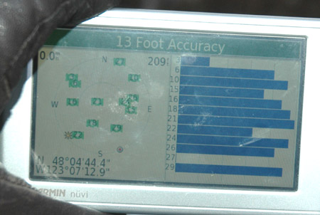
GPS location of crest gauge in Eureka Ditch behind 755 W Washington St
'
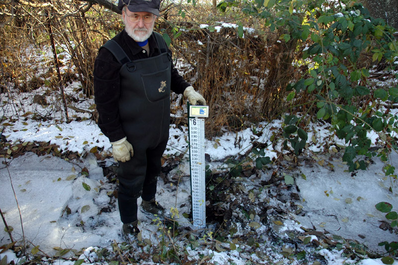
Crest gauge installation
Crest gauge reference point
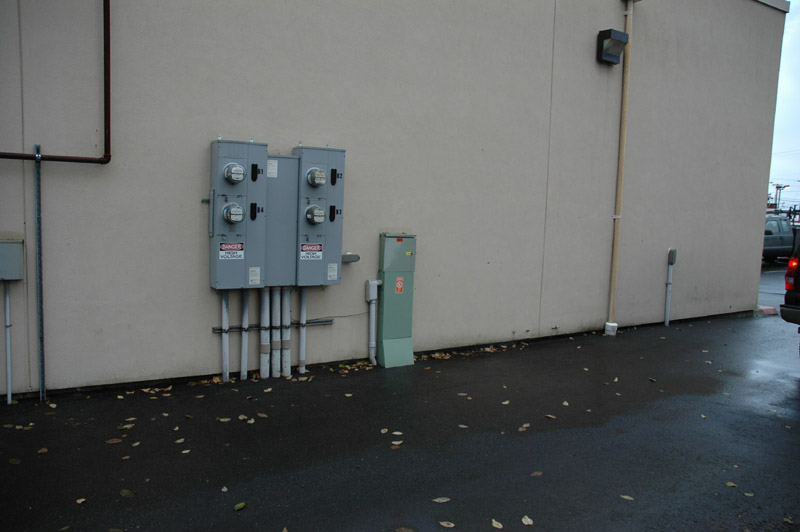
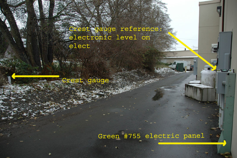
View of electric panels behind #755 W Washington St
Green top of green panel is reference point
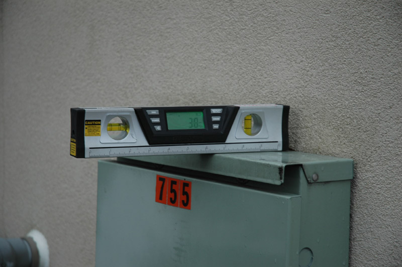
Close-up of electronic laser level on top of electric panel (magnets built into bottom of level hold it in place)
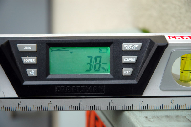
Electronic level shows a downward slope of 3/8"/foot when attached to top of electric panel with magnet
30' to crest gauge
Overview of crest gauge installation the day after installation with water flowing after thaw
 Water depth: 12/17/2008 @ 1533
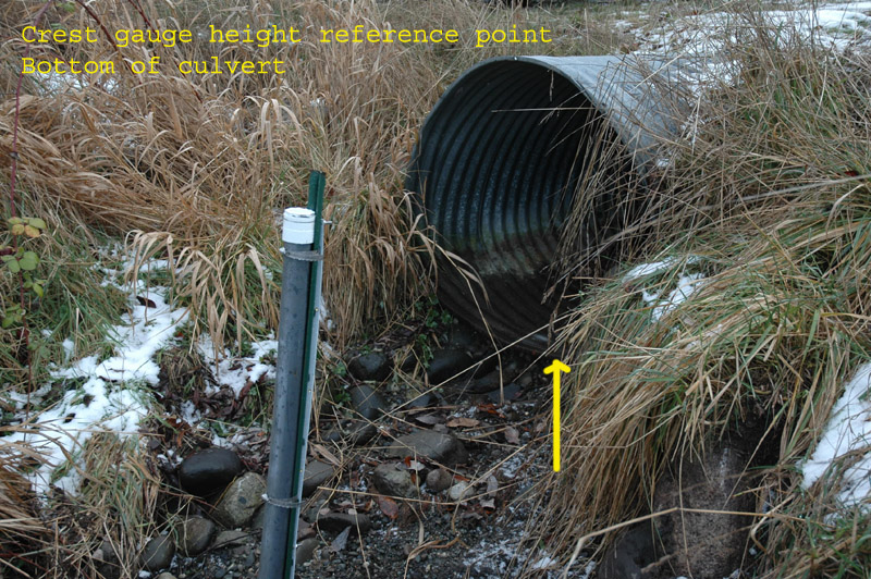
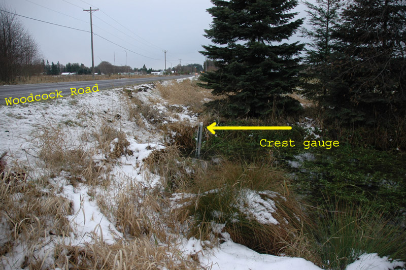
7 - Lotzgesell Creek d/s Woodcock Rd (top of page)
GPS Location of crest gauge at Lotzgesell Creek d/s of Woodcock Rd
Crest gauge installation
Overview of crest gauge installation
Looking west
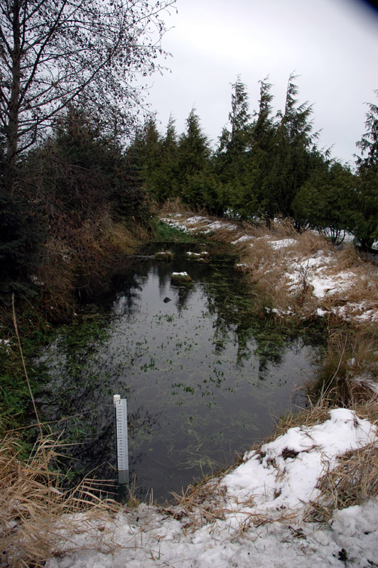
Overview of crest gauge installation
Looking north from Woodcock Rd
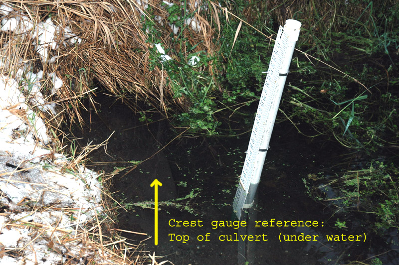
Two views of crest gauge height reference point; top of culvert under water
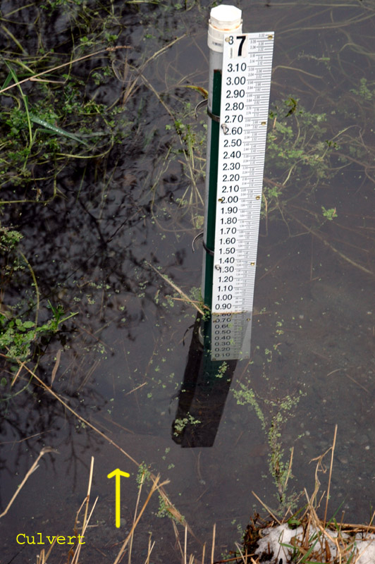
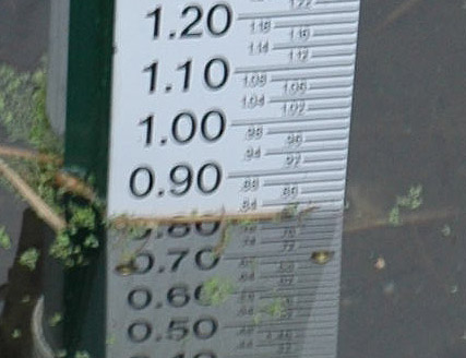 Water depth: 12/17/2008 @ 1551
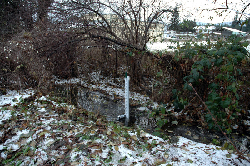
8 - Meadowbrook Creek u/s ditch (top of page)
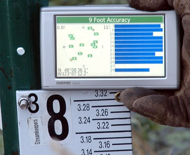
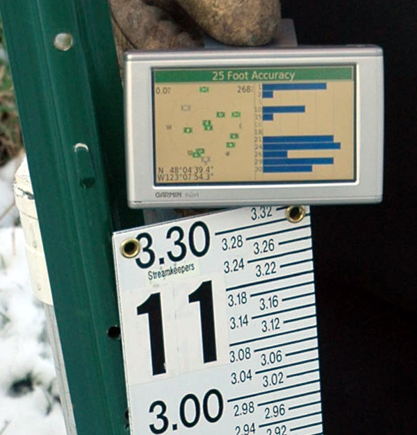
GPS location at Meadowbrook Creek u/s of ditch
N 48º 08' 36.1"
W 123º 07' 12.2"
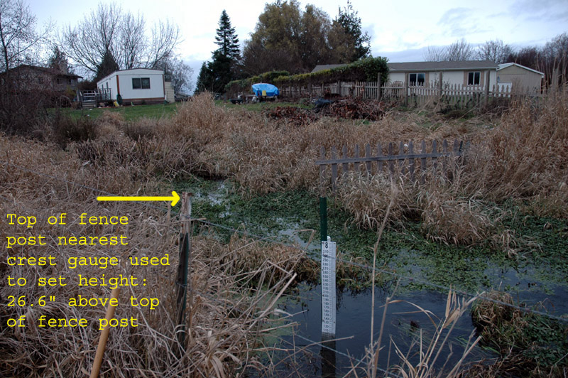
Location of crest gauge relative to homes on Meadow Drive
Level set on top of fence post to determine height
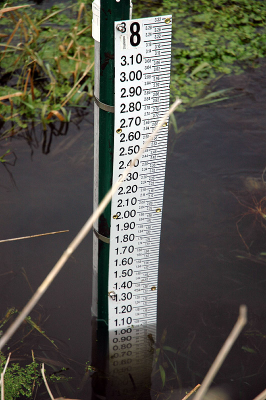
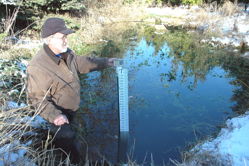
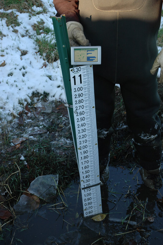
Depth 12/21/2008 @ 1521 hrs
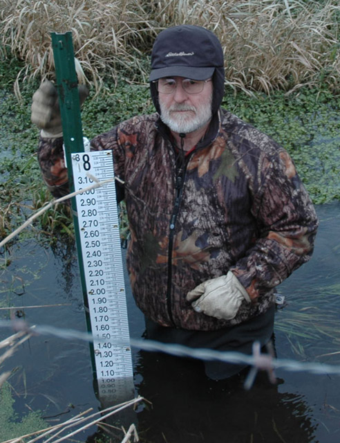
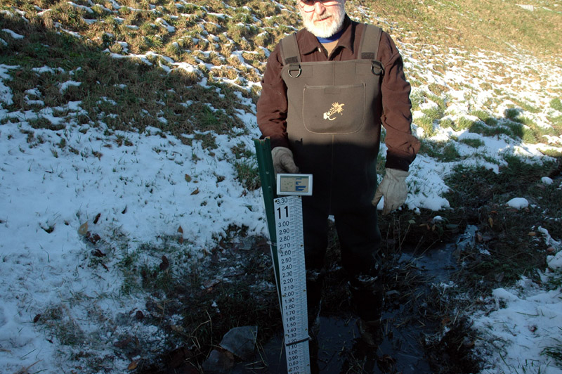
Don't underestimate the depth of Meadowbrook Creek or the softness of the bottom - my right foot was sinking deeper as this photo was taken.
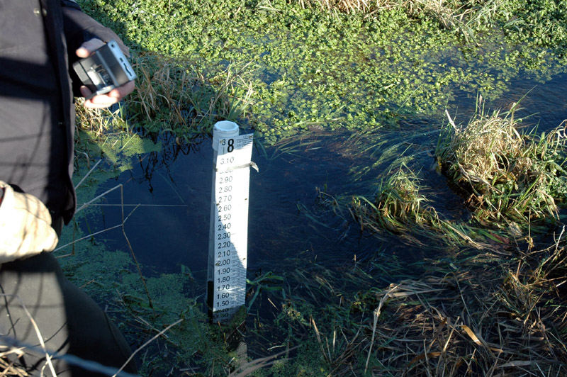
Crest gauge original installation in edge of bank slope in creek bed
Needs to be reinstalled with much taller stake because creek is deep & bottom is very soft
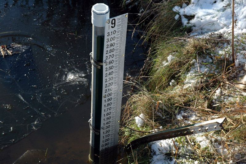
9 - Meadowbrook Ditch u/s Meadowbrook Creek (top of page)
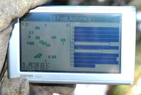
GPS Location
N 48º 08' 33.1"
W 123º 07' 10.1"
10 - Safeway parking lot catch basin; in front of store (top of page)
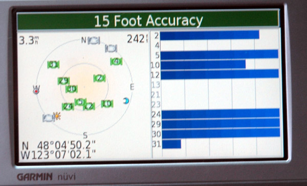
GPS Location
N 48º 04' 50.2"
W 123º 07' 02.1"
View of catch basin in front of store
Looking south
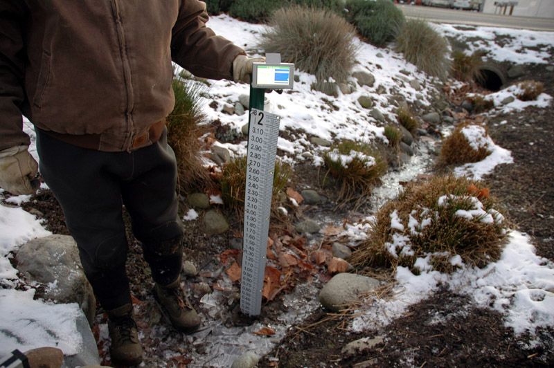
GPS location of crest gauge at Home Depot swale (west end)
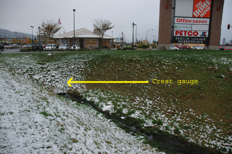
Overview of crest gauge at Home Depot swale
Looking west
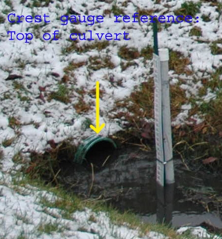
Crest gauge height reference; top of culvert at west end of swale
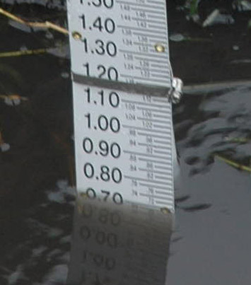 Water depth: 12/17/2008 @ 1539
(top of page) [this site was aborted on 4/14/2009]
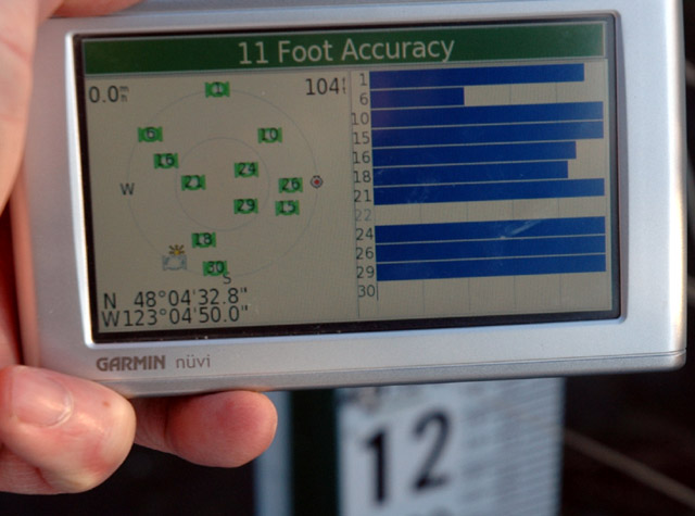
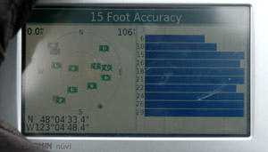
GPS location of crest gauge site
N 48º 04' 32.8"
W 123º 04' 50.0"
Crest Gauge installation
Water Depth: 12/19/2008 @ 1450: 0.96'
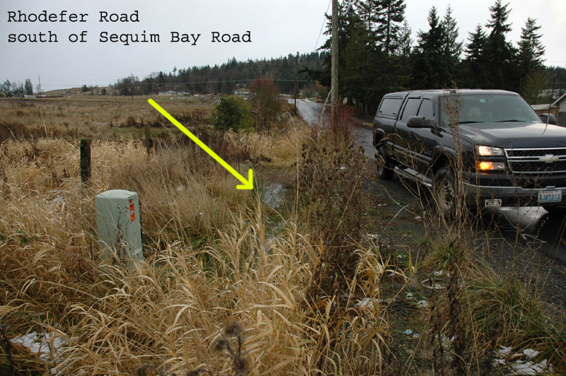
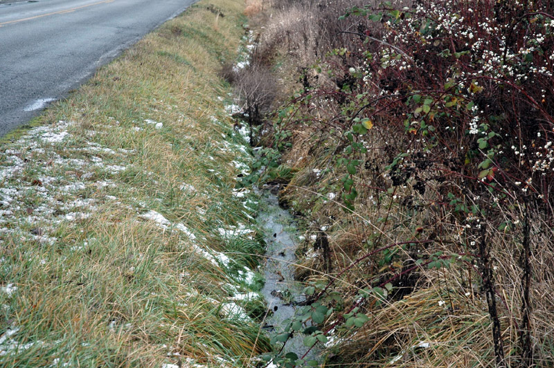
Neighborhood view of crest gauge in ditch on east side of Rhodefer Rd
Looking NE
Crest Gauge height benchmark: distance above top of telephone box
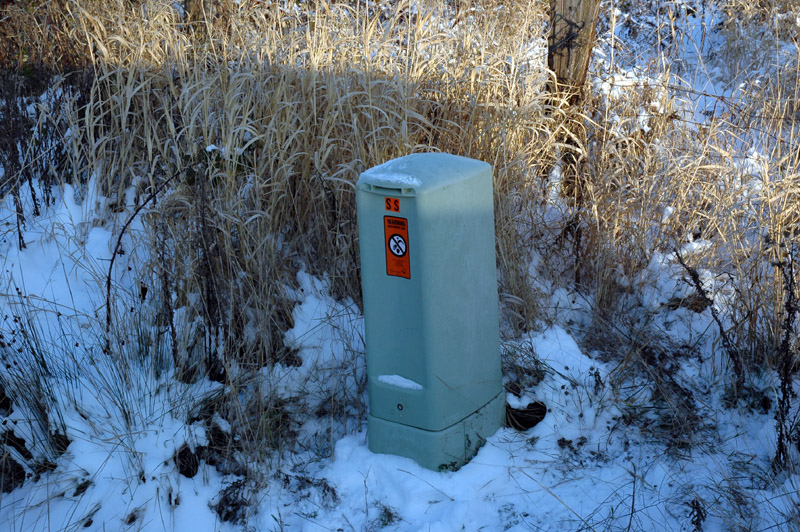
Crest gauge height benchmark
RECON IMAGES:
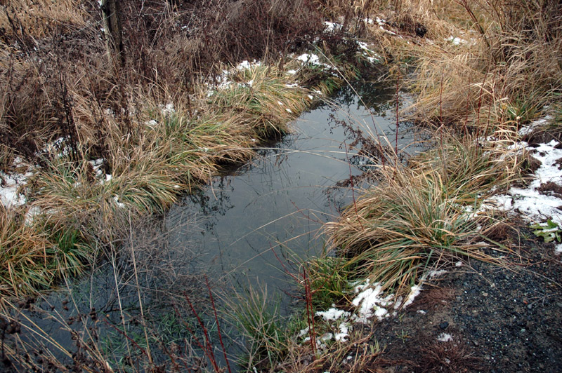
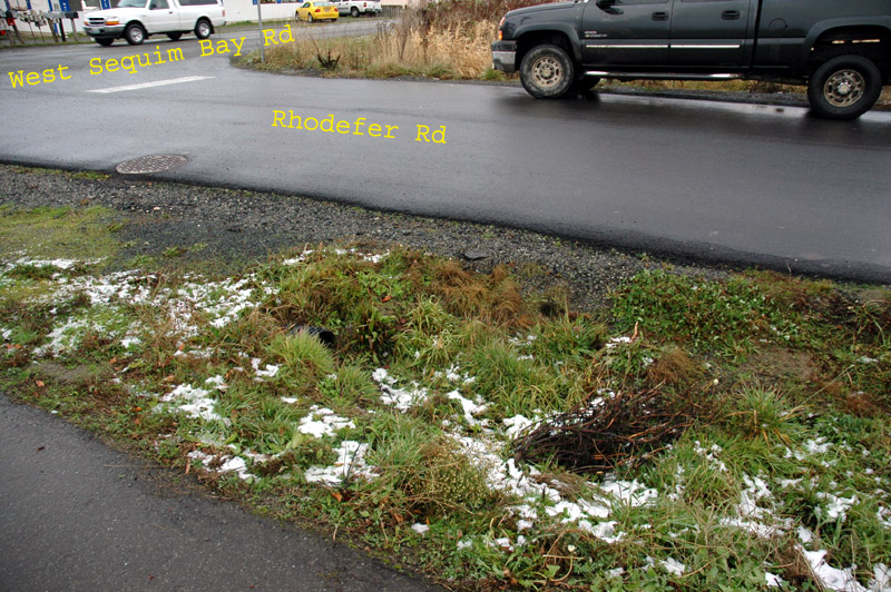
Crest gauge site
South of West Sequim Bay Rd on east side of Rhodefer Rd
Looking south
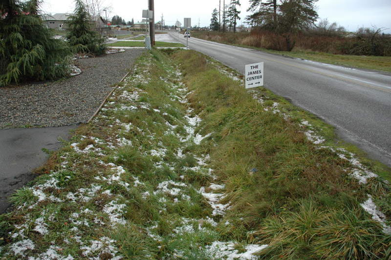
Crest gauge site
Ditch at SE corner of intersection
Looking NE
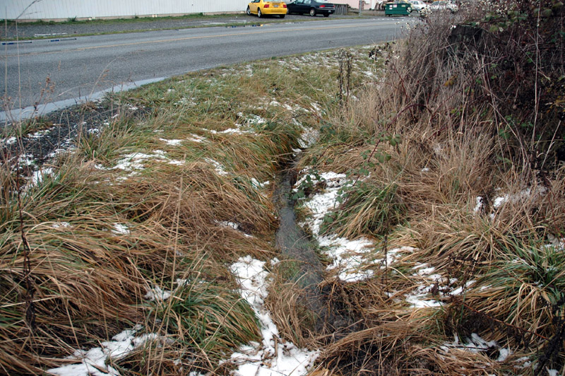
Looking east along W Sequim Bay Rd (with the flow)towards cross culvert under road
Location of cross culvert under W Sequim Bay Rd that drains the Rhodefer Rd crest gauge site
Looking SE - ditch & crest gauge site on far side of truck
Looking west along W Sequim Bay Rd
from SW corner of intersection with Rhodefer
empty ditch that drains ditch on west side of Rhodefer
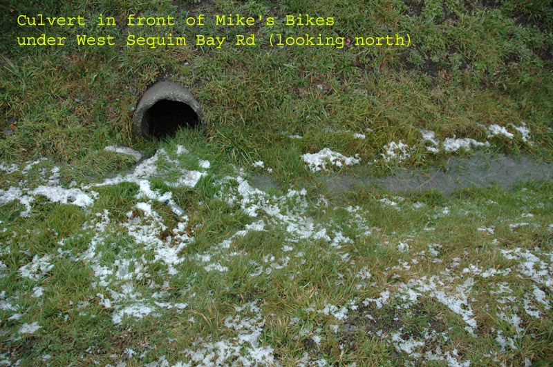
Cross culvert in front of Mike's Bikes that runs under W Sequim Bay Rd
Drains water from culvert on east border of Mike's Bikes
12 & 14 - Jimmy Come Lately Creek
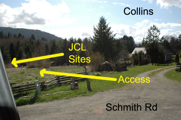
View of Collins place from Schmith Rd
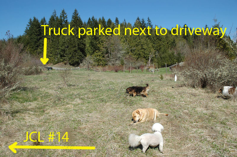
Looking back at the truck parked next to Collins driveway from 'trail' at Site #14 (Field version of creek)
(their house it to the left)
The trail up the hill to JCL #12 . . .
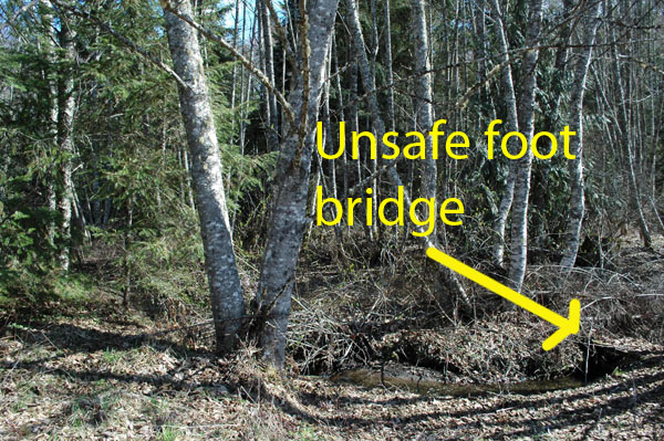
Unsafe footbridge at otherwise convenient site on wooded creek
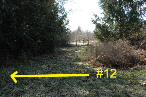
Turn left near end of trail to access JCL #12
View from trail (vantage point of previous photo)
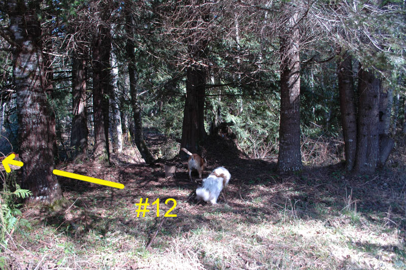
View of JCL #12 in wooded creek
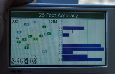
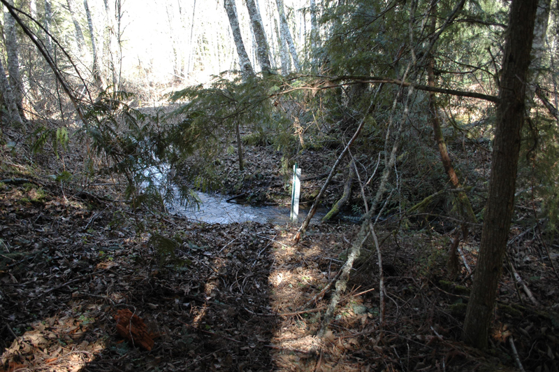
GPS of JCL #12 crest gauge
What happens when CJ takes the photos - I have tree limbs in my face.