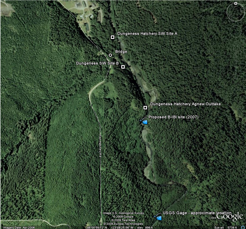
Dungeness Fish Hatchery Stormwater Site Recon
11/06/2009
Google Earth Overview

Proposed Site "A"
Access:
 | Drive through hatchery gate after main building |
 | Follow service road as it turns right behind large pond with avian netting |
 | Turn left onto smaller service road almost immediately, continue to bear left |
 | Follow service road to fire pit on right - STOP - river bank access on your left |
Location of parked truck
Parked truck - river bank access visible to left
Better view of river bank access
Close up of river bank access
U/S of site
View across river at site
Partial D/S view from site
D/S view from site
Looking back to parked truck and future SIL
Looking forwards along access road. Either follow straight to T intersection at larger access road to Agnew Outtake or turn right around trees and return to hatchery complex.
Looking at fire pit, picnic table etc. There used to be a small leanto structure here, but some kids burned it down.
Agnew Outtake at end of service road - FYI pix
GPS of parked truck
Elevated walkway to Agnew Outtake & Dungeness River
Dungeness River U/S of Agnew Outtake. Must climb ladder to elevated walkway & follow walkway & trail to river.
Downed tree on right provides access along cliff wall to outcrop just to the
right of image center. There used to be 2 more fallen trees crossing the
river from outcrop to gravel bar on far side of river. Proposed 2007 B-IBI
site was at small side channel to left of gravel bar.
Deep pool taken from same vantage point as previous image.
Same vantage point at previous photo, but turned more to left to show elevated walkway from end of service road
View of truck parked at end of service road. A vertical ladder to the walkway is on the right side of platform ahead.
View of river immediately D/S of Agnew outtake, taken from walkway
View of Agnew Ditch and parking area at end of service road. Turnaround area is adequate, but narrow.
Proposed Site "B"
Access:
 | Direct access via one of the main service roads at the hatchery complex |
 | Follow to the GPS coordinates - river close to road at bench on log rounds on left |
Location of parked truck
View of truck & river bank access (truck is headed back towards hatchery
River bank access just D/S of small outcrop (semi-protected from flow)
A second access just U/S of outcrop, so not protected at all
Looking back at truck & bench from site
Bridge over large stream flowing into Dungeness
GPS location of bridge
View of stream & Fish Hatchery Road above from bridge
View of bridge deck looking towards hatchery