
The Mackenzie Highway North thru Alberta & the Northwest Territories to Yellowknife
June 13th thru 20th
| Day # | Date | Description | Link |
| 08 | June 14th | Dawson Creek, BC to Manning, AB |
|
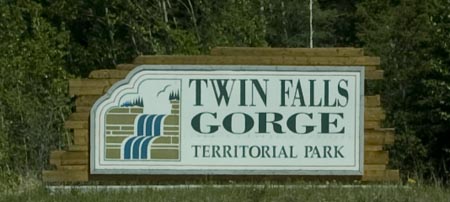
| 09 | June 15th | Manning, AB to Twin Falls Territorial Park, NWT |
|
| 10 | June 16th | Twin Falls Territorial Park, NWT |
|
| 11 | June 17th | Twin Falls Territorial Park, NWT to Fort Providence, NWT |
|
| 12 | June 18th | Fort Providence, NWT to Yellowknife, NWT |
|
| 13 | June 19th | Yellowknife, NWT |
|
| 14 | June 20th | Yellowknife, NWT |
|
Day # 8 -
Sunday, June 14th - Dawson Creek to Manning, AB
![]()
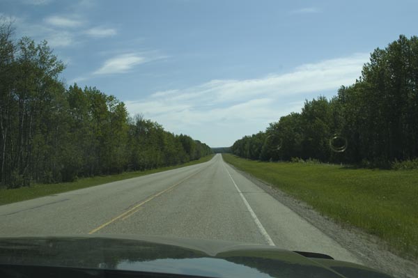
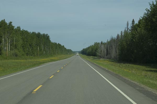
The highway in Alberta - much greener than we remember from the Canada #1 further south
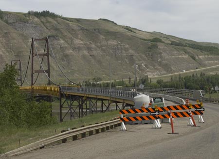
Construction on the Peace River Bridge narrows the bridge to just one lane. Note how skinny that lane is. We had just 1 foot of clearance on each side so I had to keep the rig in the straight & narrow middle.
The Peace River
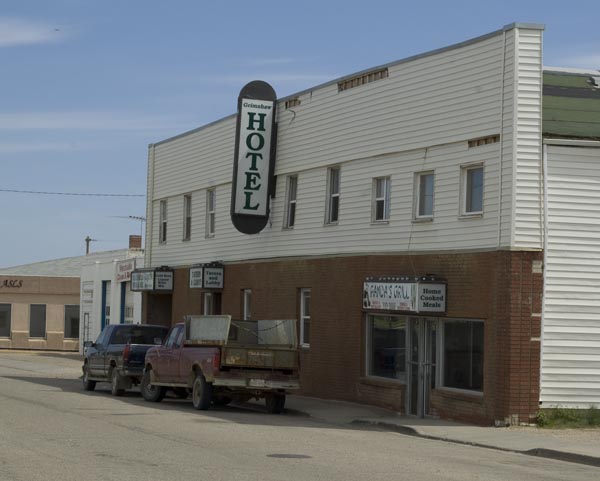
Downtown Grimshaw, AB
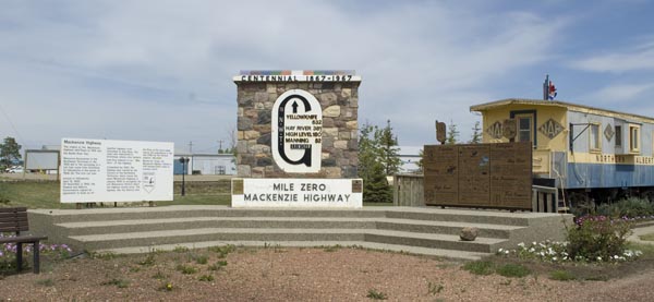
Mile Zero of the Mackenzie Highway. Quite important to the folks in Alberta and the Northwest Territories, but virutally unsung compared to Mile Zero of the Alaska Highway.
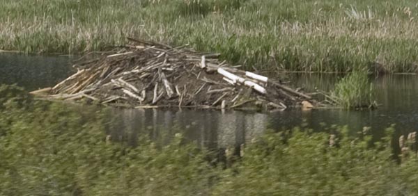
One of a zillion beaver lodges in the many, many lakes along the highway.
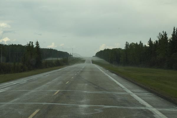
Weather ahead. I saw this & knew something weird was going on ahead weather-wize. We encountered rain briefly & the outside temperature dropped like a stone; several degrees per minute. By the time we entered the fog in the photo, there was white stuff on the ground. Snow at this elevation?
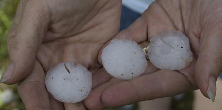
We discovered the hail when we stopped at Twin Lakes Provincial Park about a mile later. Hail stones as big as golf balls. Some folks in a minivan in front of us got their hood thoroughly dimpled. There were 2 RVs in the park at the time and both received extensive damage. All we got was photos. Whew!!
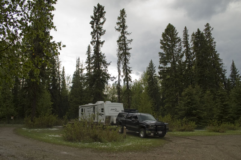
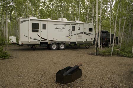
Our campsite at Twin Lakes Provincial Park, north of Manning, AB
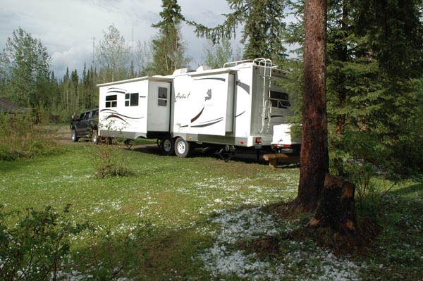
Another view of the campsite showing the hail on the ground. This photo was taken 2 hours after we arrived.
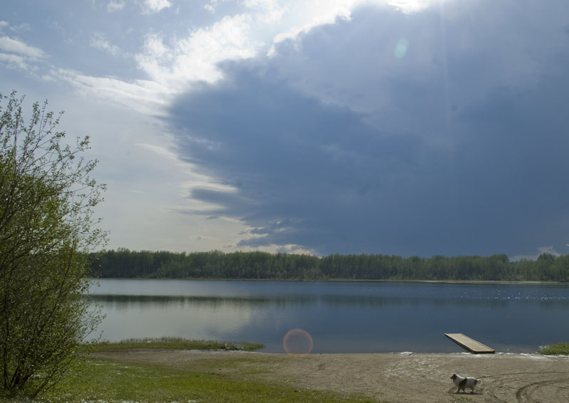
One of the Twin Lakes
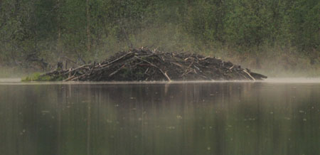
A beaver lodge on the far side of the lake taken with my 150-500mm zoom.
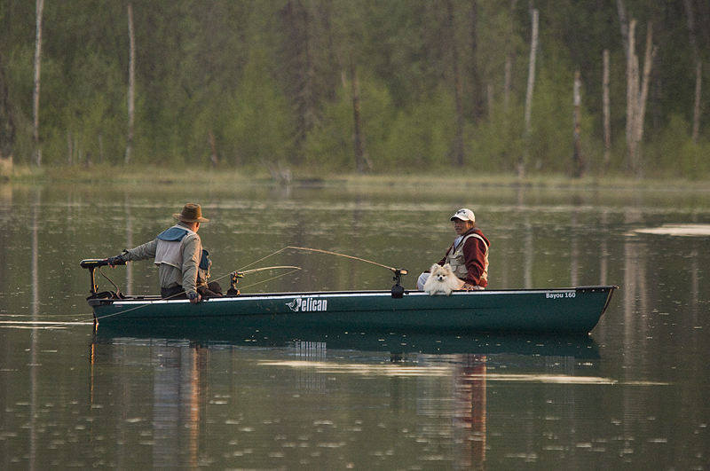
A local couple fishing with their little dog on the far side of the lake.
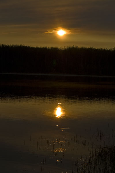
I was hoping for a nice sunset shot over the lake, but after waiting for an hour, the colors fizzled and this was the best of the lot.
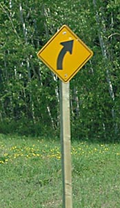
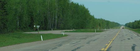
The roads in Alberta run straight as an arrow, mile after mile. So when there is a turn, they need to warn the driver. Still, they only need a handful of these.
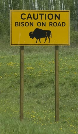
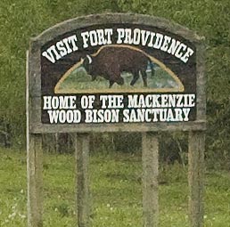
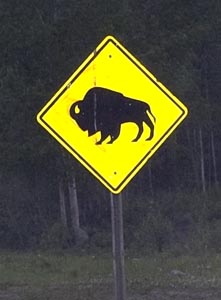
A rare sign in western Alberta. There is a huge bison
reserve in eastern Alberta, but we're not going there this trip. The silly
Collie-Wollie would probably try to herd them if we find some.
Bo'sun
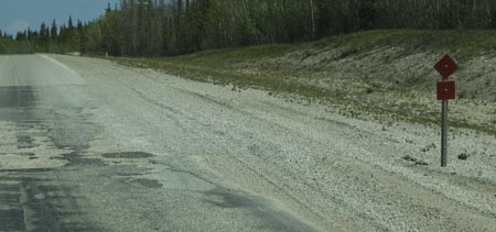
A deceptively simple but common sign to be on the lookout for, especially when you're driving an RV. The basic sign is 1 red diamond (or triangle in Alaska) and it means there is some kind of a bump in the road. If the sign is on the right side of the road, then the bump is on the right side, and if it's on the left then the bump is on the left. If there are two diamonds/triangles like in this case, then the bump is supposed to be quite bad. Of course, there are signs next to non-bumps and mild bumps that can be taken at speed, but get complacent at your own risk. Some bumps are killers and may only one sign. We flipped our dining room table over twice in 2004.
 There
are probably hundreds of "roadside pullouts" in western Canada. Most are
like the one on the left where you can really get off the highway. A few
are much larger, but some are just wide spots like the one on the right.
All of them have bear-proof litter bins.
There
are probably hundreds of "roadside pullouts" in western Canada. Most are
like the one on the left where you can really get off the highway. A few
are much larger, but some are just wide spots like the one on the right.
All of them have bear-proof litter bins.
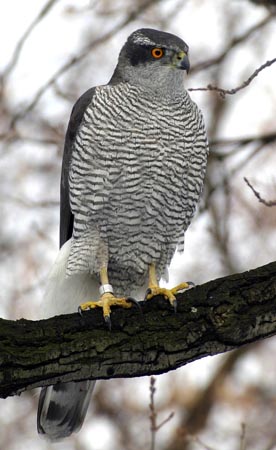
We saw 3 of these Northern Goshawks today, plus a couple of their nests. (photo from AnimmalPicturesArchive.com)
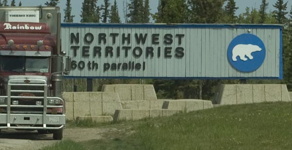
The long awaited sign - we've reached the Northwest Territories
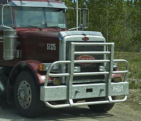
A close-up of the type of grill guard almost every truck up here has. These guards are 3/8" thick and designed to stop a moose with no damage to the truck or grill guard. Needless to say, dad wants one for his truck!
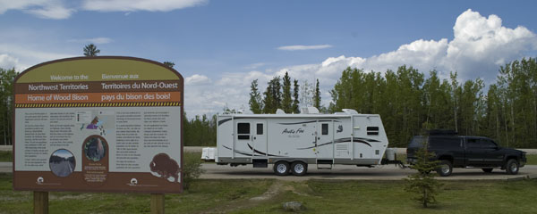
We're parked outside the Visitor Center at the Northwest
Territories border. The folks inside gave mom & dad the certificate below
and a cup of coffee. They left us in the rig and we didn't even get a
treat.
Bo'sun

This is where we're staying for a couple of days. Would
you believe with all that water in the river, they don't have any in the
campground?
Bo'sun
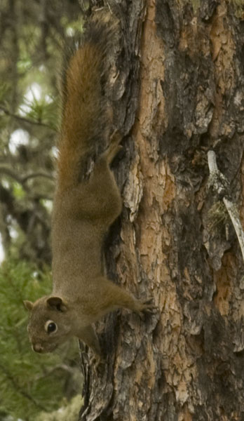
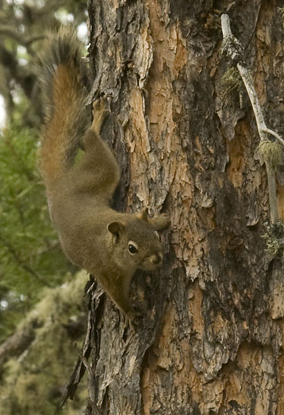
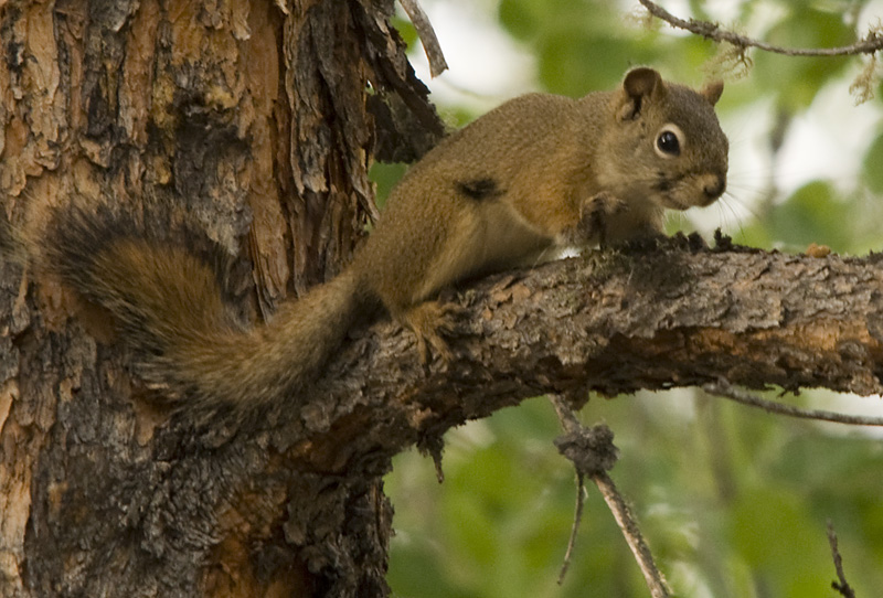
 I
spotted this little Red Squirrel in our campground and naturally I chased him to
a tree a few feet away. Boy, did he chatter at me! Dad was setting
up his camera to take photos of the ravens that were scavenging the fire pit so
he took some nice photos of this little guy. Even I think he's cute!
I
spotted this little Red Squirrel in our campground and naturally I chased him to
a tree a few feet away. Boy, did he chatter at me! Dad was setting
up his camera to take photos of the ravens that were scavenging the fire pit so
he took some nice photos of this little guy. Even I think he's cute!
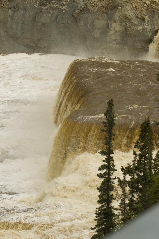
Louise Falls at Twin Falls Gorge. Yes, the water is at
least that brown. I was eaten alive by mosquitoes while dad took photos of
the falls.
Gracie
Day # 11 - Wednesday, June 17th, Twin Falls to Fort Providence, NWT
![]()
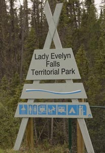
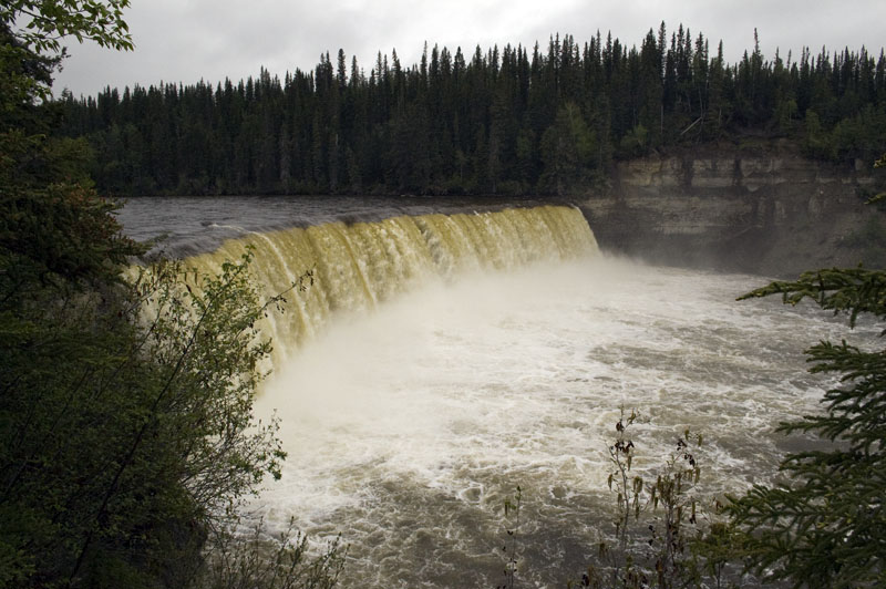
Lady Evelyn Falls
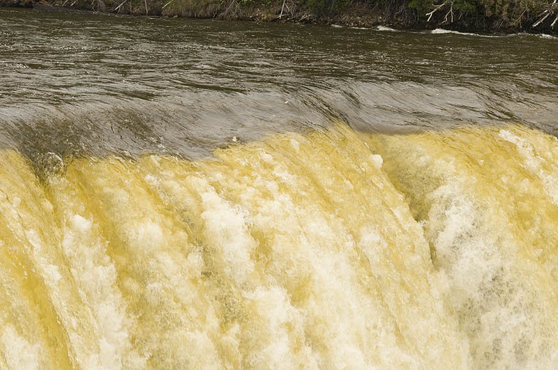
A close-up of Lady Evelyn Falls
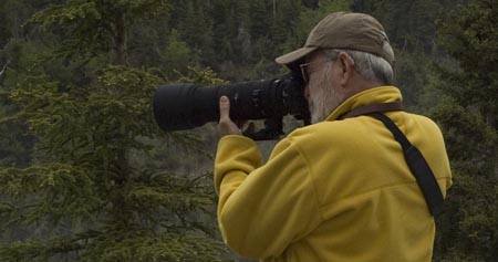
Steve takes close-up photos at Lady Evelyn Falls with his Nikon D90 & 80-200mm F2.8
Bridge construction on the Kasika River
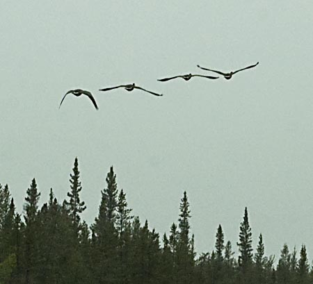
Four Canada Geese take off after waddling down the highway in front of us
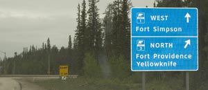
Turning onto Highway 3 to Fort Providence and Yellowknife.
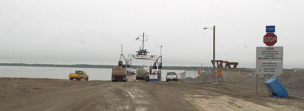
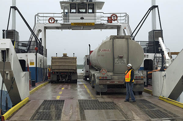
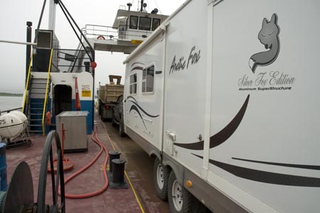
Our first view of the Fort Providence Ferry. No fancy terminal or dock here. We had to shift into low range, 4-wheel drive to get off the ferry on the other side because of the dip and mud it beached on. We think they get a kick out of watching the RVers deal with it.
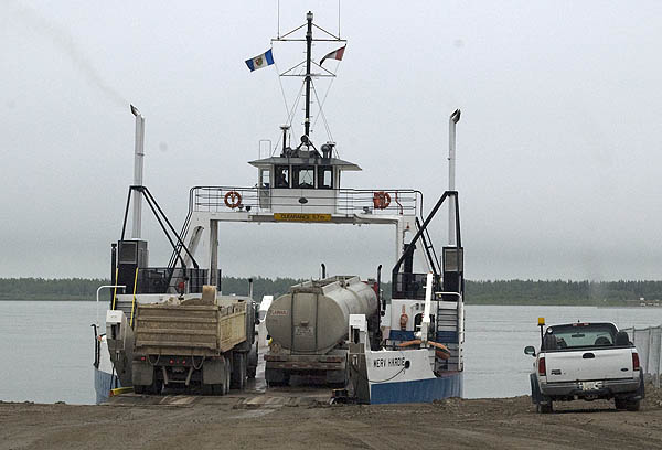
Two big rigs and two RVs and the ferry is full.
The lady bo'sun guides us onto the ferry.
The open door is to the engine room - security is lax, needless to say.
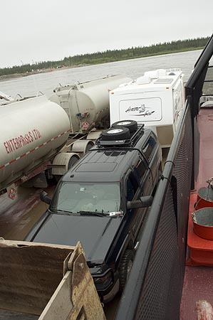
Two big rigs and two RVs and the ferry is full.
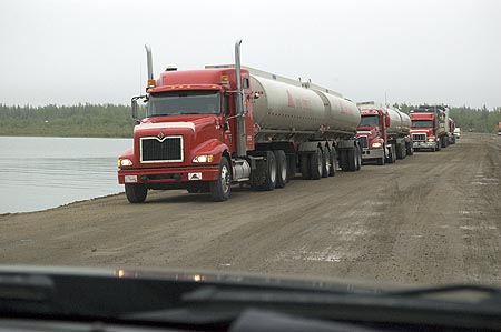
The line of south-bound trucks waiting for the ferry

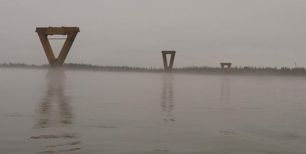
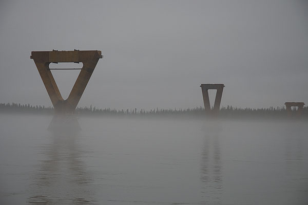
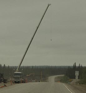
The Deh Cho Bridge under construction. Taken from the ferry.
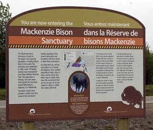
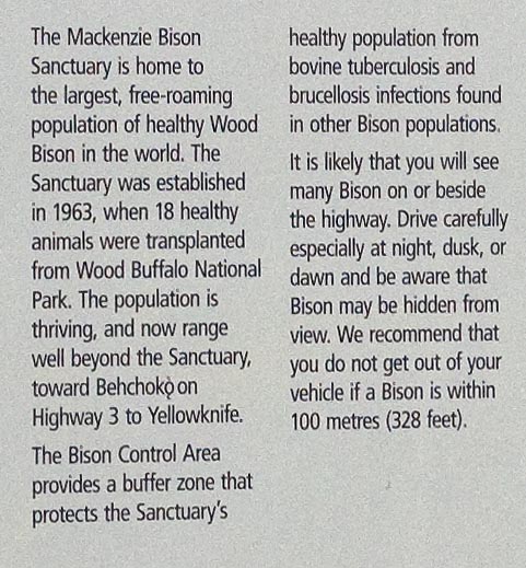
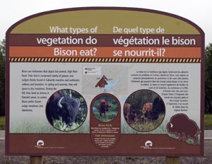
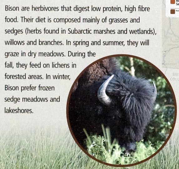
Informational signs about the Wood Buffalo along the highway
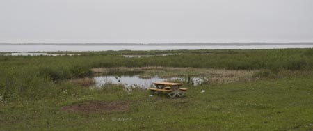
The little roadside pullout where we had lunch after crossing the ferry
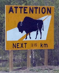
Our first warning sign of Buffalo
Just down the road, another warning sign
Our first true sign of buffalo was spotted at the pull out just after the ferry crossing
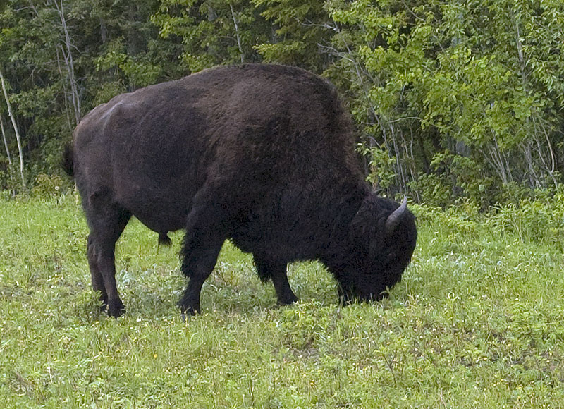
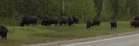
We'd hoped we get a chance to see some Wood Buffalo on the leg between Fort Providence and Yellowknife, but we never imagined that we'd see hundreds of them. Just a couple of kilometers out of Fort Providence, we ran into a herd of roughly animals. This photo is just a handful of them. Every few miles for the next 100+ miles we saw a few or a small herd. Needless to say, we took lots of photos. Here's a few of them.

Our campground at Fort Providence Territorial Park.
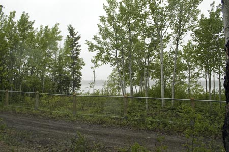
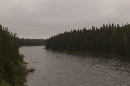
The view of the river from our site
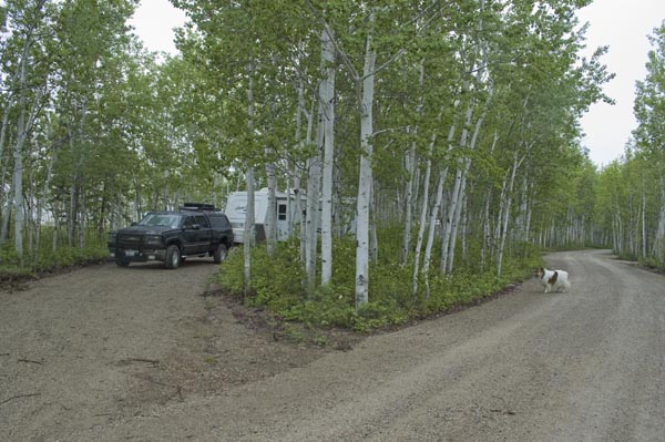
As usual, Gracie inspects the site after we've set up.
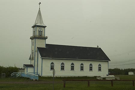
The church in Fort Providence
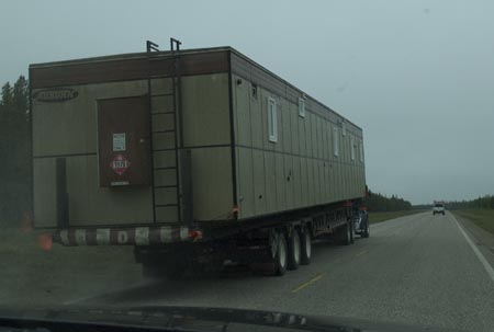
Getting passed by an office building.
Day # 12 - Thursday, June 18th - Fort Providence to Yellowknife, NWT
![]()
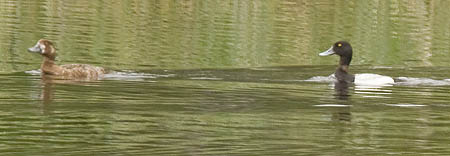
A pair of Lesser Scaup
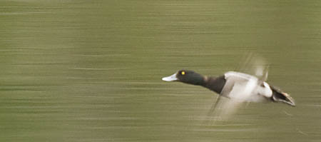
Lesser Scaup takes off
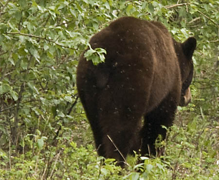
The north end of a south-bound black bear
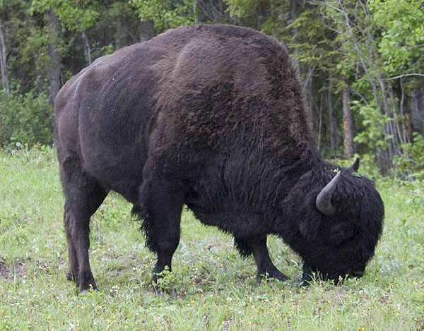
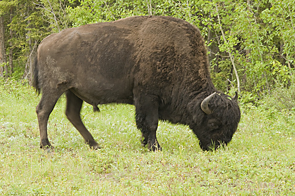
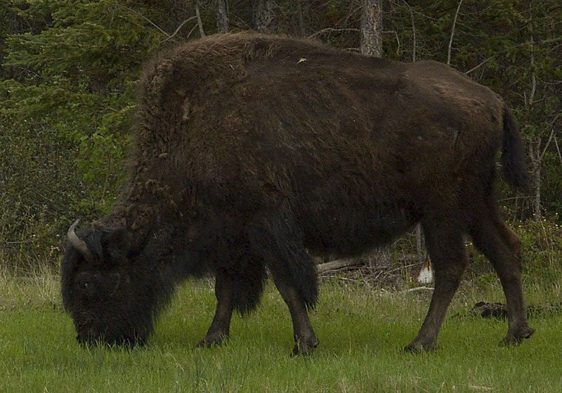
A portion of one of the many herds of Wood Buffalo along the Yellowknife Highway
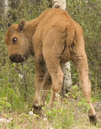
This calf is scratching his shoulder on a tree
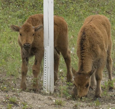
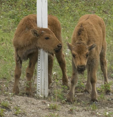
Two calves play and rub on a sign post
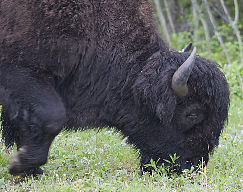
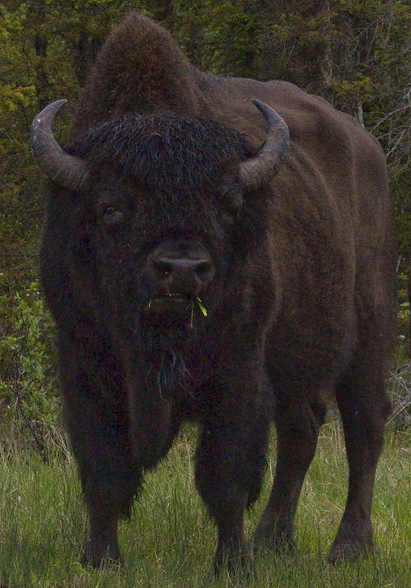
Such a handsome face
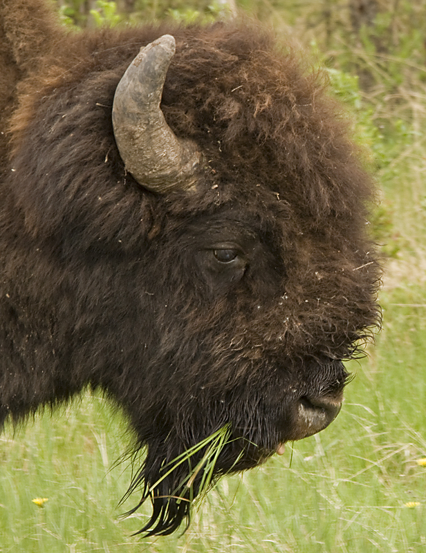
Almost total attention is given to eating. Well, almost . . .
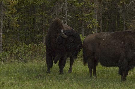
"Hey there pretty girl."
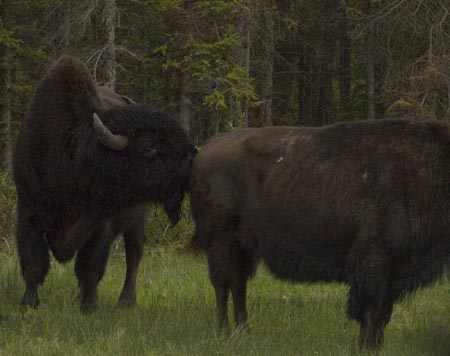
Mmm. I think this girl smells good.
Oh yeah, she smells real nice!
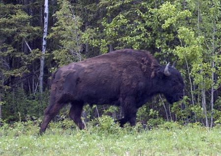
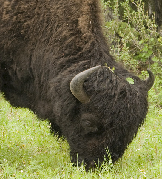
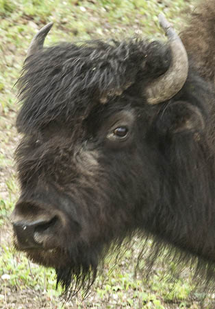
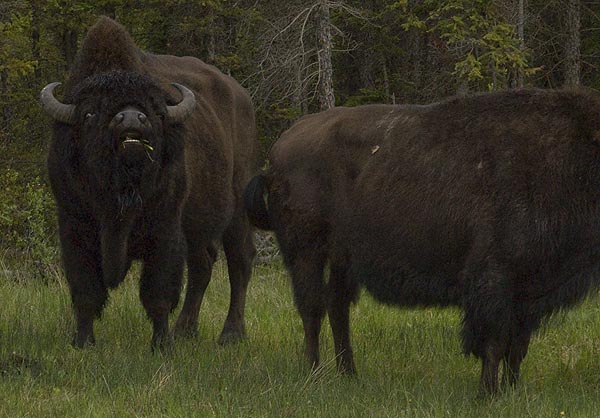
This photo shows the subtle differences in curvature between the horns of the male and female Wood Buffalo. That and the relative size are the only clues that the Gov't brochure gives to tell the difference between the boys and the girls.
This is a male.
This is a female.
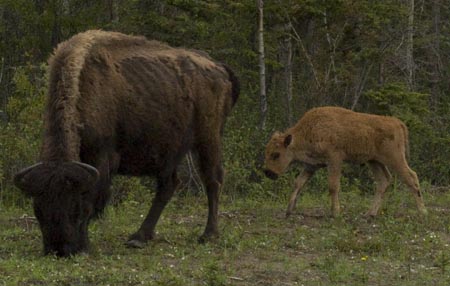
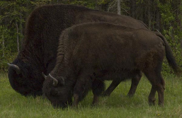
A momma bison and her calf
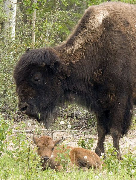
Another mom & calf
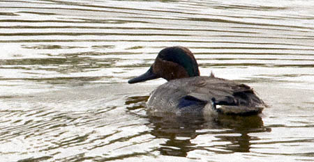
A male Green winged Teal
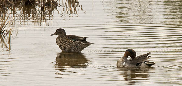
A pair of Green-winged Teals
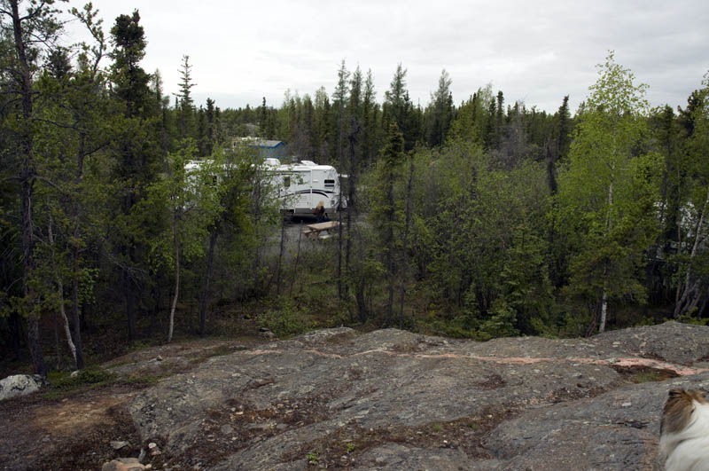
Our campsite at Fred Henne Territorial Park viewed from the top of some exposed "Canadian Shield" - preCambrian bedrock that covers 1/3 of Canada
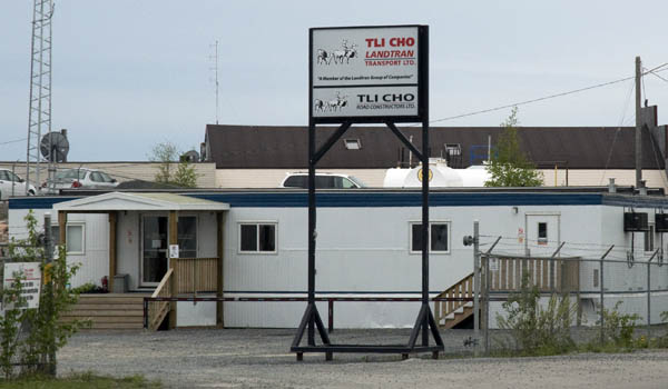
The dispatch center of the Ice Road Truckers TV series
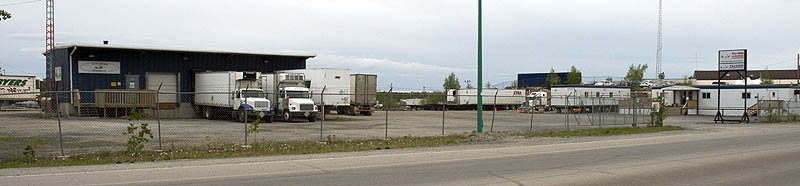
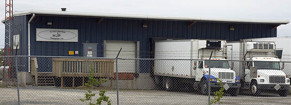
A general view of the trucking terminal
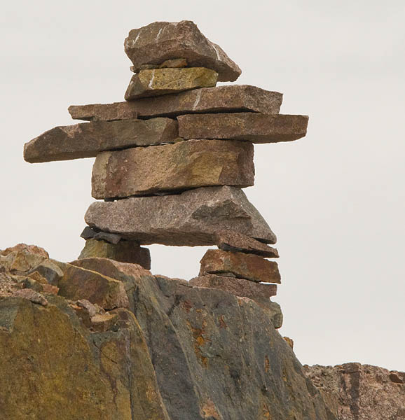
An Inukshuk along the Yellowknife Highway.
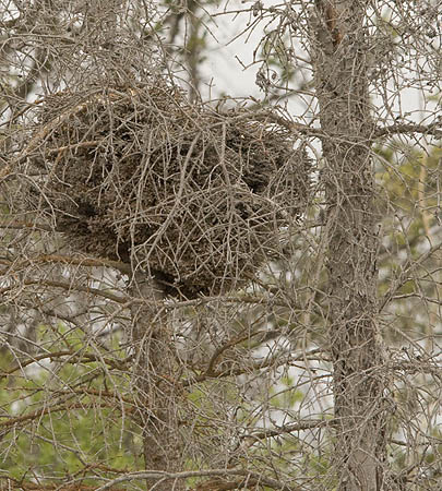
A raptor nest
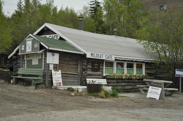
The Wildcat Cafe is one of Yellowknife's oldest buildings, built in 1937. We had ice cream for desert on Thursday.
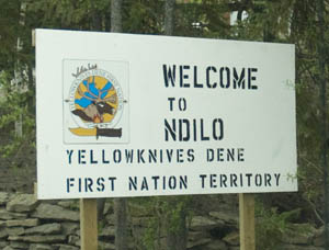
Ndilo is a small First Nation Territory at the end of the island a the end of old town.
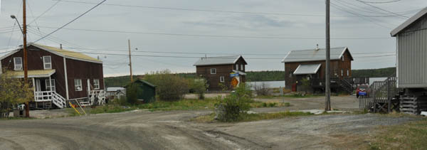
A typical section of Ndilo
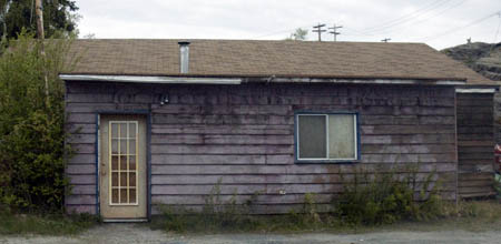
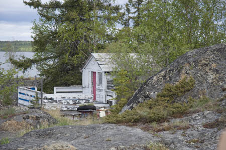
Two older houses in Old Town
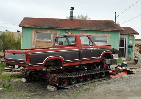
A fully winterized Ford F-250
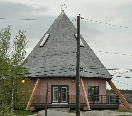
Many First Nation houses have teepees outside. This one got carried away.
There are many very interesting, and probably quite expensive, homes between Ndilo and the main part of Yellowknife in Old Town along the water and on the hill overlooking the water.
Day #13 - Friday, June 19th - Yellowknife, NWT
![]()
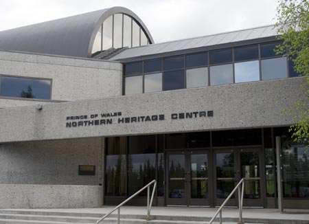
Prince of Wales "Northern Heritage Center" in Yellowknife, NWT
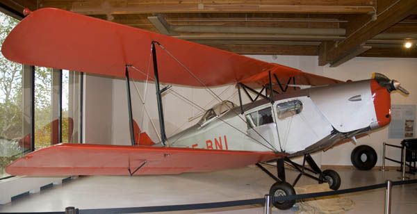
1932 Fox Moth airplane. Note the cabin windows; 3 lucky passengers get crammed into that cabin. Also very unusual for the era is the enclosed cockpit for the pilot.
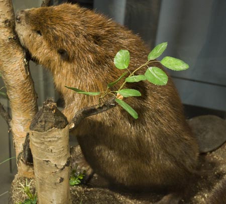
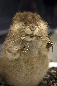
Beaver & Muskrat displays
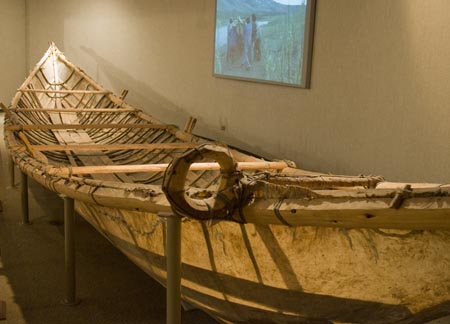
A moose-skin canoe. There was a video of the construction and passage made in this canoe. The passage wasn't just a couple of guys out for a day sail in the lake, either. It was an extended family, their dogs and all their stuff--the canoe had less than a foot of freeboard--on a wild river.
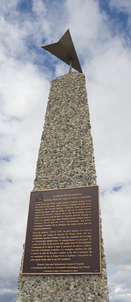
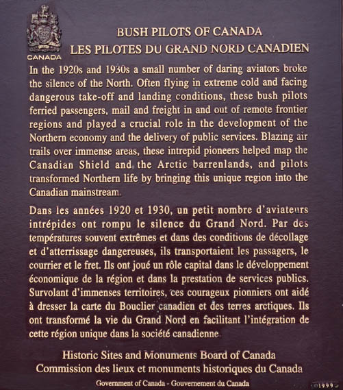
The Pilot's Monument on "The Rock" in Old Town Yellowknife
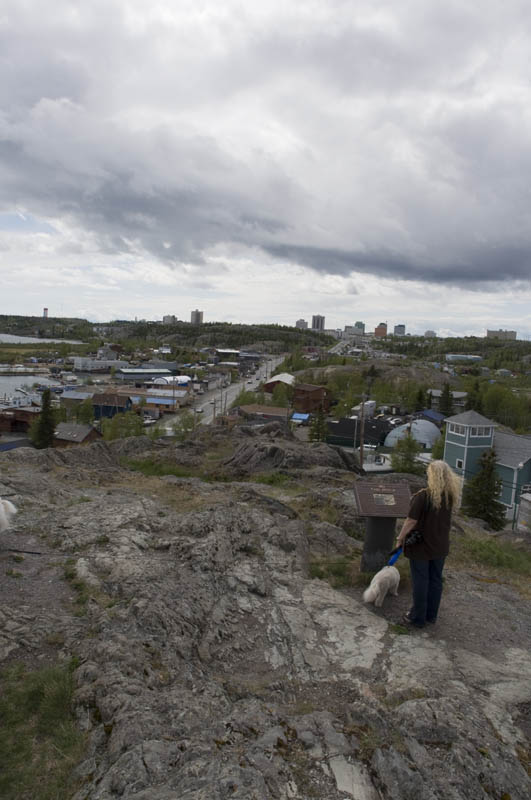
Yellowknife skyline in the background from the top of the Rock
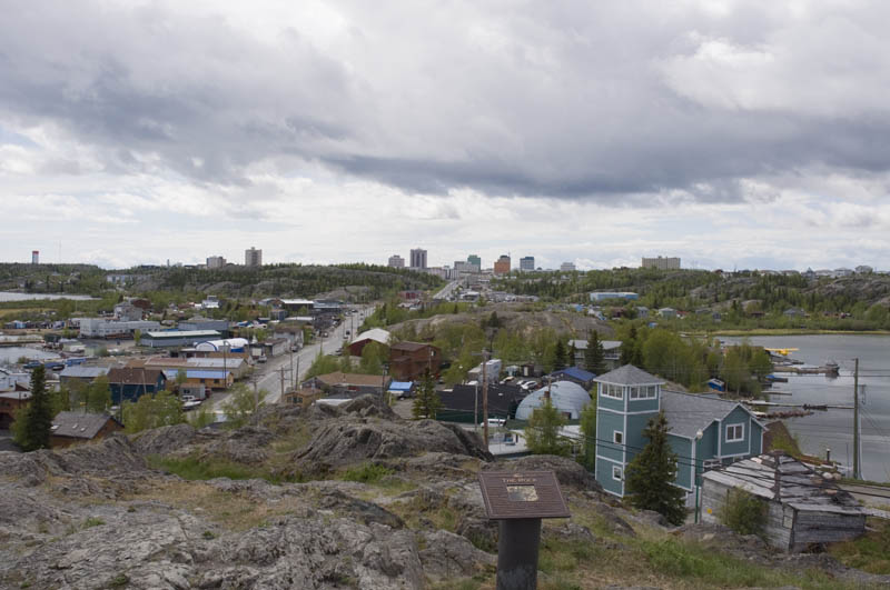
Another view of the Yellowknife skyline
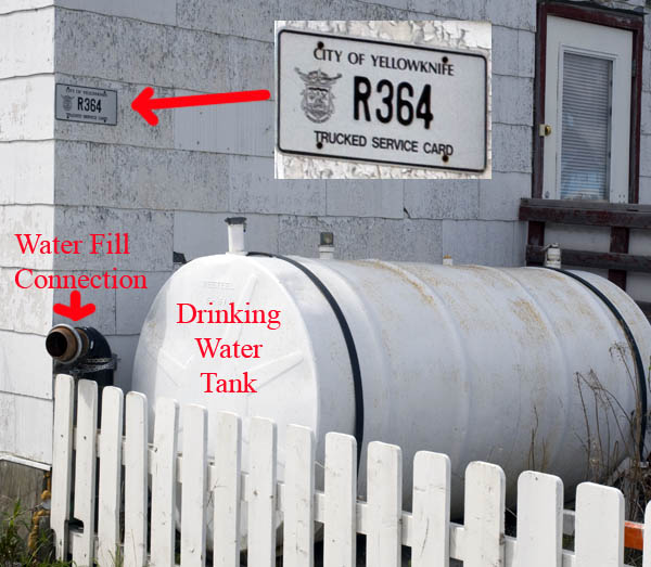
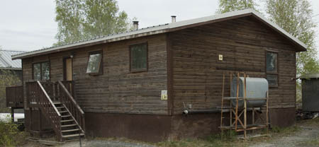
An example of the trucked in water system at a home in Old Town Yellowknife
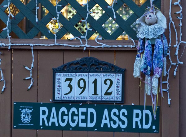
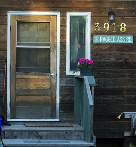
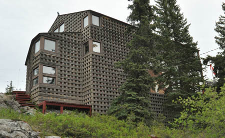
A couple of the homes on Ragged Ass Road in Old Town
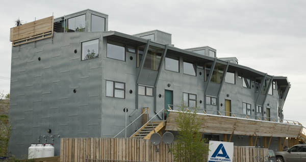
An interesting apartment building in Old Town
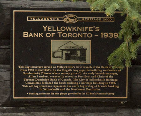
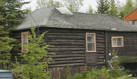
Yellowknife's 'Bank of Toronto, circa 1939, is now a private home
Day # 14 - Saturday,
June 20th - Yellowknife, NWT
![]()
We drove the length of Highway 4 - the Ingraham Trail - today. Got some great photos along the way and at the end of the road where the Ice Road begins in the winter. We'll try to get the photos ready for uploading by the time we reach Fort Nelson on Wednesday, and if we can find a WiFi hotspot, we'll post them then.
In the mean time, we'll be traveling part of the Deh Cho Route and the primitive road to Fort Nelson, B.C. Our progress along the way can be monitored via our SPOT page.